top of page

Welcome to Consejo Shores Real Estate
Real Estate in Consejo Shores – Homes, Land & Waterfront Living
Discover Your Dream Property in Belize's Premier Residential Community
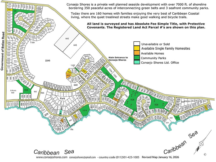
Consejo Shores Development Map
The development map shows the location of home-sites, three private seafront parks, a 9-hole golf course,
a greenbelt park, roads, and the yet-to-be-developed land within the Consejo Shores community.
Google Earth Web has a current (2/26/25) aerial view of our entire community.
Parcel numbers and street numbers (address) are different. Please refer to this list for the street address of each parcel.

bottom of page